/
NISAR
Launch Success
Liftoff Time (GMT)
12:10:00
Wednesday July 30, 2025
Watch Replay
Official Livestream
Mission Details
Read Article
Track Payloads
NISAR
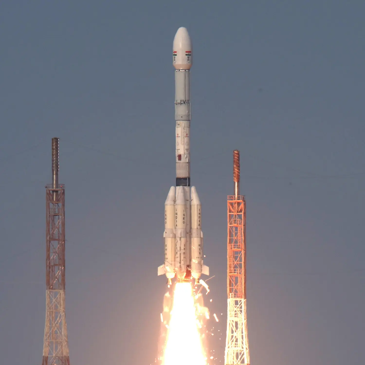
The NASA-ISRO Synthetic Aperture Radar, or NISAR satellite, will use advanced radar imaging to map the elevation of Earth's land and ice masses 4 to 6 times a month at resolutions of 5 to 10 meters. It is designed to observe and measure some of the planet's most complex natural processes, including ecosystem disturbances, ice-sheet collapse, and natural hazards such as earthquakes, tsunamis, volcanoes and landslides. Under the terms of the agreement, NASA will provide the mission's L band synthetic aperture radar (SAR), a high-rate telecommunication subsystem for scientific data, GPS receivers, a solid-state recorder, and a payload data subsystem. ISRO will provide the satellite bus, an S band synthetic aperture radar, the launch vehicle, and associated launch services.
Sun-Synchronous Orbit
1 Payload
2,393 kilograms
Rocket
Agency
ISROPrice
$47.00 million
Rocket
Height: 51.7m
Payload to Orbit
LEO: 5,000 kg
GTO: 2,500 kg
Liftoff Thrust
7,887 Kilonewtons
Fairing
Diameter: 4m
Height: 7.8m
Stages
3
Strap-ons
4
Launch Site

SE
SW
Launching
South
Stats
GSLV Mk I & II
18th
Mission
2nd
Mission of 2025
Indian Space Research Organisation
99th
Mission
3rd
Mission of 2025
2025
167th
Orbital launch attempt