/
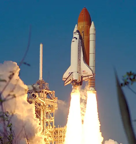
STS-99
Launch Success
Liftoff Time (GMT)
17:43:40
Friday February 11, 2000
Watch Replay
Official Livestream
Mission Details
STS-99
The Shuttle Radar Topography Mission (SRTM) was an international project spearheaded by the National Imagery and Mapping Agency and NASA, with the participation of the German Aerospace Center DLR. Its objective was to obtain the most complete high-resolution digital topographic database of the Earth. SRTM consisted of a specially modified radar system that flew onboard Endeavour during its 11-day mission. This radar system gathered around 8 terabytes of data to produce high-quality 3-D images of the Earth's surface.
Low Earth Orbit
13,154 kilograms
Rocket


Agency
NASAPrice
$450.00 million
Rocket
Height: 56.1m
Payload to Orbit
LEO: 27,500 kg
GTO: 3,810 kg
Liftoff Thrust
30,250 Kilonewtons
Stages
2
Strap-ons
2
Launch Site
Stats
Space Shuttle
97th
Mission
1st
Mission of 2000
2000
11th
Orbital launch attempt